The Ashanti Region is the cultural heartbeat of Ghana. Land of the Golden Stool expressed in the language, passage rites, festivals, cuisine and ordinary day-to-day activities.
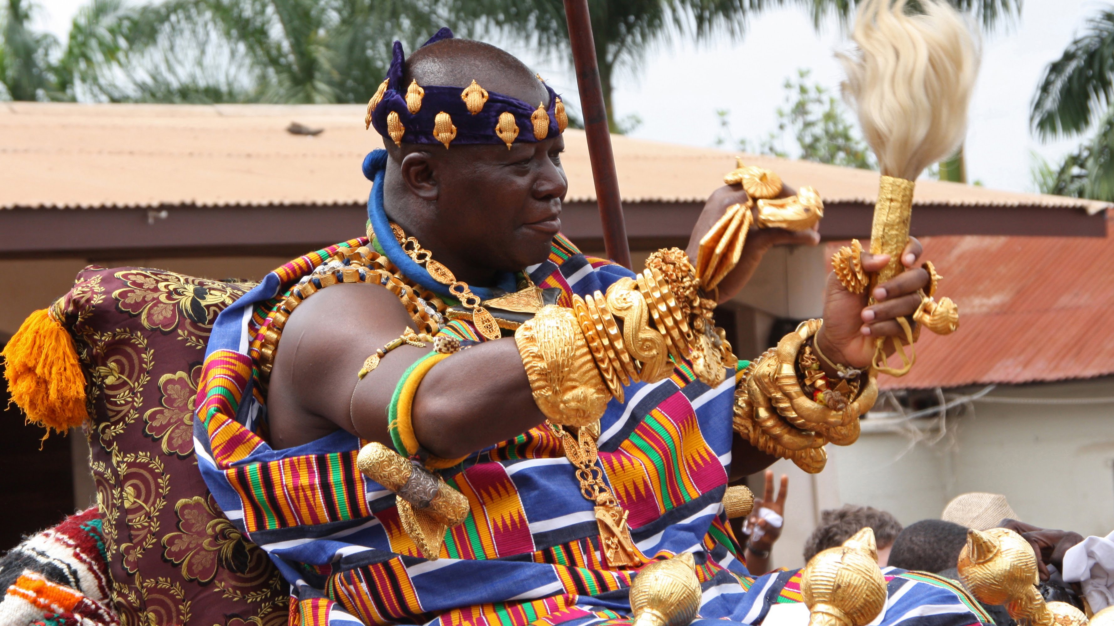 His Majesty (HM) Otumfuo Nana Osei Tutu II - Asantehene
Visitors can participate in several traditional events such as funerals, naming ceremonies. Royal Akwasidae held every six weeks at the Royal Palace of the Asante King, Otumfuo Osei Tutu II.
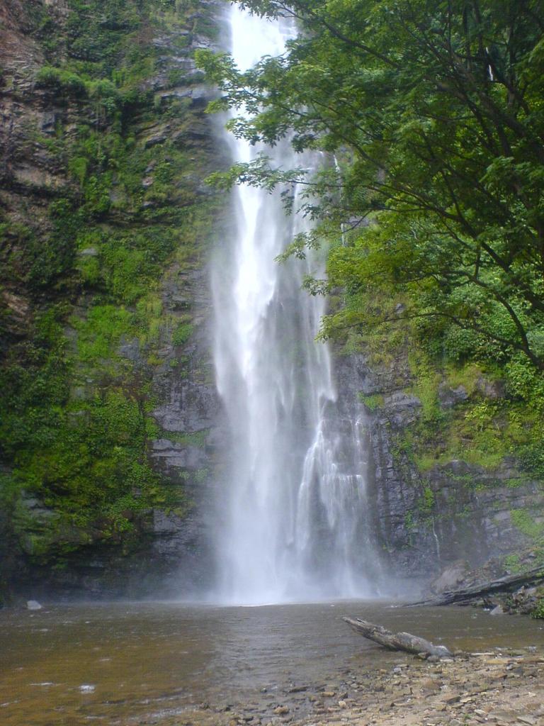
The scenic and hilly capital city of Kumasi is a vast tropical rainforest belt. Still forest country, dominated by impressive buttress rooted forest giants, alongside large cocoa farms and picturesque hillside settlements.
Beautiful weather; chilly in the mornings, bright, clear and sunny in the afternoons for most of the year and cool nights provide ideal conditions for visitors to; experience this exciting colourful world of hearty hardworking people.
Ashanti is also home of the most important god mine in Ghana at Obuasi (50km south-west of Kumasi). Surface visits can be arranged, and the town still has air of the gold rush days of the 1890s.
Throughout Ashanti (and especially in Kumasi) you will find welcoming hotels and restaurants, while in the main towns nightlife and entertainments are first class. Sporting facilities are available in the urban areas, while exciting fishing can be enjoyed in our lakes and rivers. To discover the traditional heartland of Ghana, a visit to Ashanti is a must.
Let us welcome you to Brong Ahafo, the region at the heart of Ghana.
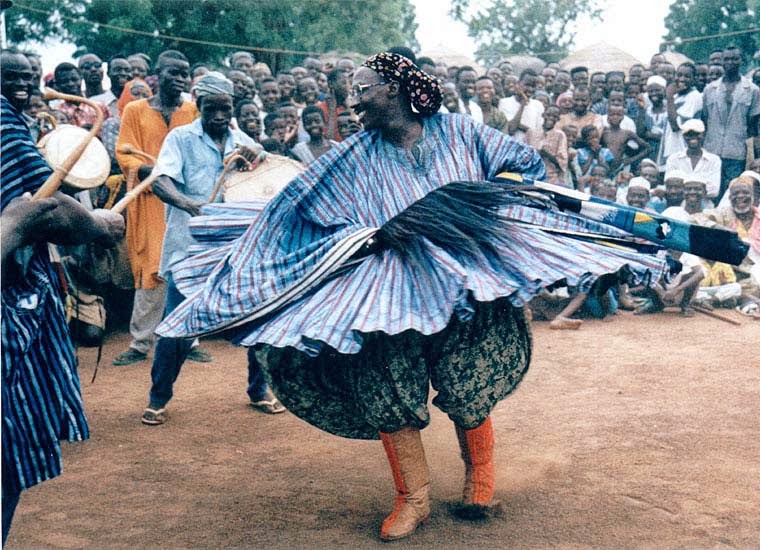 Fordjour (Yam Festival) – Batakari Dancer
With a multiplicity of ethnic groups, physical features, cultural practices that dates back into antiquity, tourist attractions opportunities for investment in all sectors of the economy especially tourism, and of an open, and warm-hearted people, ready to welcome you and make your stay in Brong Ahafo a memorable one.
Sunyani, the captail of the Brong Ahafo Region is linked to Accra by a first class road and is about seven hours drive between them, at a relatively regular pace. From Sunyani you may then begin your tour, which will take you to the major tourist attractions of Brong Ahafo.
Created on 4th April 1959 out of the then Western Ashanti, Brong Ahafo is the second largest region of Ghana in terms of landmass with a territorial size of 39,557,O8sq.kms.
The region is bordered on the north by the Northern Region, Ashanti and Western on the South, Eastern and Volta on the Southeast and east respectively, and the Republic of La Cote d'ivoire to the west.
According to the 2000-population census, the Brong Ahafo region has a population of about 1,824,827 with an average growth rate of 3.1 % and an economically active part of 45% representing the 15-65 age bracket.
The Region has a tropical climate with high temperatures of between 230C and 390C, enjoying however maximum rainfall of 450 in the northern parts to 650 in the south of the region.
There are two main types of vegetation namely the moist semi deciduous forest mostly in the southern and southeastern parts of the region, and the guinea savannah woodland predominantly in the Northeastern portion of the region.
Brong Ahafo has thirteen (13) administrative districts: Sunyani, Asutifi, Tano, Berekum, Dormaa Asunafo, Techiman, Wenchi, Sene, Nkoranza, Atebubu, Kintampo and Jaman.
There are two main ethnic groups namely the Brongs and the Ahafos who are of the Akan stock. Minority groups are the Nafana of Sampa, Koulongo of Seikwa and Badu, the Mo/Degha of Mo, Libya of Banda as well as the Nchumuru of Atebubu and Sene. Akan is the lingua franca throughout the region.
There are forty-four Paramount chiefs and five Divisional Councils constituting the Brong Ahafo Regional House of Chiefs.
The Region can boast of first class roads linking its major towns to the regional capital, Sunyani and the rest of the country.
Sunyani has an airport, which connects the region by air to Kumasi, Accra and Takoradi. Air transportation is however irregular and is therefore unreliable. Lake Brong Ahafo has three in-land lake ports on its portion of the Volta Lake. These are Yeji, New Buipe and Yapei, which can all be reached from Akosombo using the Yapei Queen among others.
There is an effective communication system in place with over 6,800 direct telephone lines linking most district capitals; radio phones are used in other districts. Mobile phones are also now in use.
The thirteen (13) district capitals have been provided with electricity whose voltage is the same as the national one of 220 volts and of 3-pronged and 2-pronged out- lets.
There are a few foreign exchange bureaux in most of the district capitals dealing in monetary transactions in cedis and selected foreign currencies.
The Central Region is the former government centre of the Gold Coast.
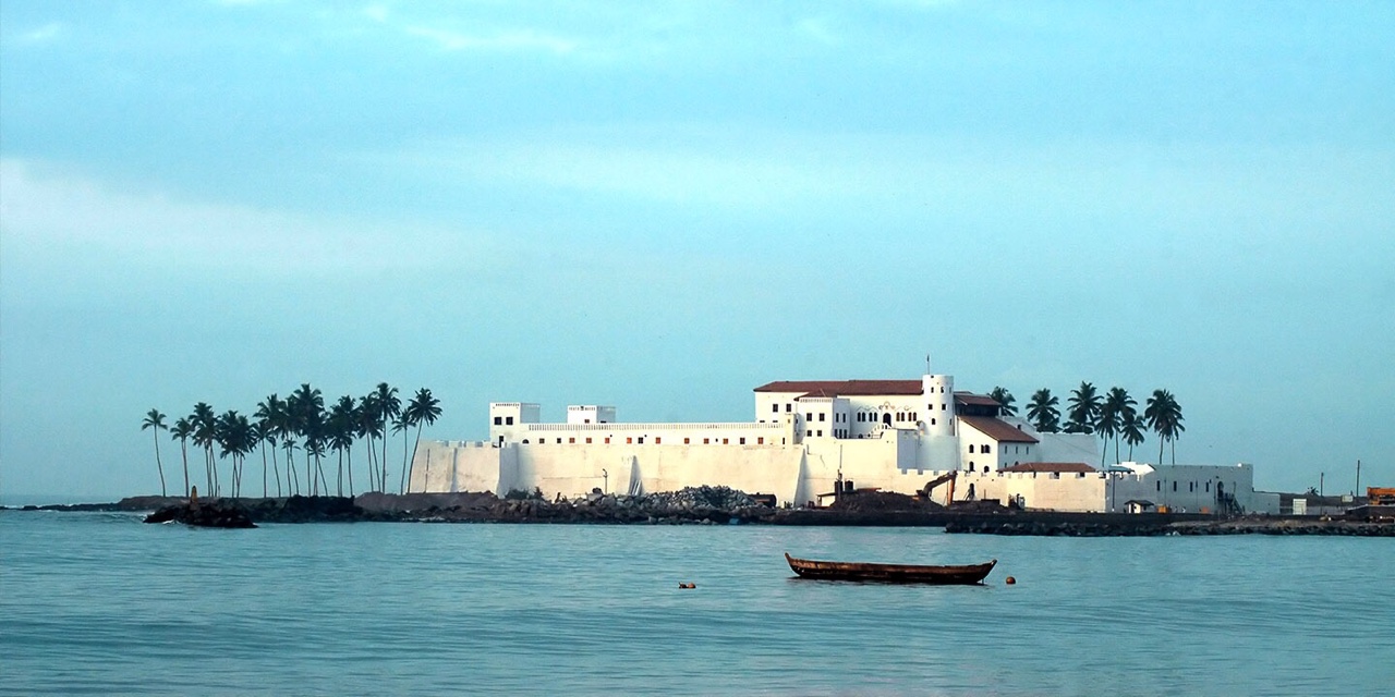 Elmina Castle
Cape Coast was the seat of the British colonial administration up until 1877. The coastline is famous for its ancient forts and castles built by early European traders, and three of them at Elmina, St. Jago and Cape Coast have been identified as World Heritage Monuments by the World heritage Foundation under UNESCO.
The Region is also famous for its palm-fringed beaches, fascinating fishing villages and historic towns, and rich natural attractions. Kakum National Park, just 30km north of Cape Coast, is the foremost nature reserve in Southern Ghana and well worth a visit. Almost untouched virgin rainforest has been preserved as a habitat for birds, butterflies and rare local animals, and Kakum is most accessible, as it is very easy to reach from Accra.
The Region's culture is depicted through its many exciting festivals which are held throughout the year. Some of the best known festivals are 'Bakatue', literally the opening up of Benya Lagoon into the sea, which symbolised the beginning of the fishing season for the people of Elmina; 'Edina Buronya', a native version of Christmas celebrated by the people of Elmina on the first Thursday of the New Year; 'Aboakyer' or game hunting, one of the most famous festivals celebrated by the chiefs and people of Winneba on the first Saturday in May; and 'Fetu Afahye' celebrated with a durbar of chiefs by the people of Cape Coast on the first Saturday of September. Another famous festival is 'Odambea' celebrated on the last Saturday in August in Saltpond Traditional Area, and reflecting a migration of the local people centuries ago.
The historic towns in the region that deserve a visit include Winneba, traditionally known as 'Simpa' Winneba; Kromantsej Abanze, the site of Fort Amsterdam; Duakwa and Mensa Krom, home of some of the Region's best woodcarvers; Ajumako aware where the carvers specialise in royal regalia, stools, linguistic staffs and clan totems.
Throughout the Central Region there are welcoming hotels and restaurants, all an easy drive from Accra. If you are seeking to discover the historical links between Africa and the Americas and Europe, or just wanting to explore a culture that has its roots in another era, or just wanting to relax on a sun-dappled beach, then the Central Region must not be missed.
The Eastern Region of Ghana is a rich blend of dramatic landscapes, historic relics and traditional cultures.
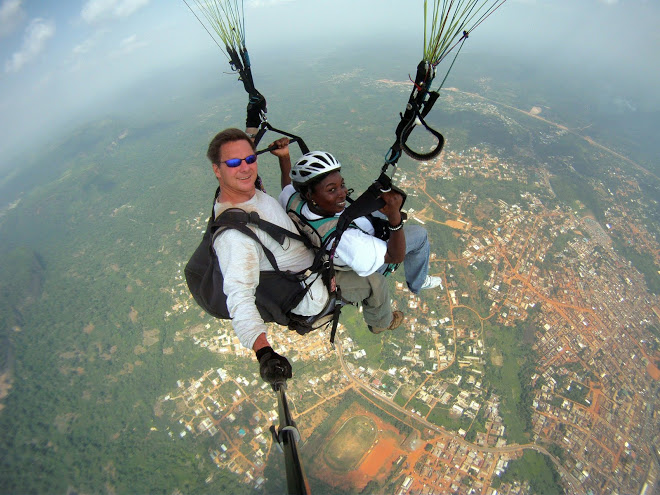 Ghana Paragliding Festival
The ancient blends with the 20th century in this region so close to but such a contrast with Accra. The region is dominated by Lake Volta, one of the world's largest man-made lakes, and the Akosombo Dam, source of much of Ghana's hydroelectric power. Both are worth a visit. A favourite excursion is the weekend trip to Dodi Islands.
Striking landscapes are overlooked by the Krobo Mountains and the Akwapim Ridge, and the countryside is great walking country. The Eastern Region is famous for its large areas of lush tropical forest, and cascading waterfalls. Fishermen will enjoy great sport fishing for tilapia in Lake Volta.
The Eastern Region contains Ghana's only commercial diamond mine at Akwatia, while the birthplace of our great cocoa industry can be found at Mampong-Akwapim. For those with a particular interest, the Cocoa Research Institute at New Tafo, with its arboreta, welcomes visitors. The regional capital is Koforidua, a pleasant traditional town with agreeable hotels and a busy market.
Traditional and historic villages and towns are part of the richness of the Eastern Region of Ghana. Visitors should take the opportunity of visiting the original Presbyterian school buildings in Akropong, and the house of Tetteh Quarshie in Mampong. Both these towns have many interesting historic buildings and districts.
Many visitors introduction to the Eastern region is the botanical gardens at Aburi, which were opened in 1890, and have always been a favourite excursion from Accra. Also worth a visit is the forest of Atewa-Atwirebu, hundreds of birds and butterflies.
Latitude 5 40 and 7, 10 North, and longitude 08 east, 1 15' of the Greenwich Meridian.
It shares boundary on the north with Brong-Ahafo and Ashanti Regions, on the East with Volta Region, on the west with Central and Greater Accra on the south.
The capital town of the eastern Region is Koforidua about 85km scarp from Accra.
Temperatures in the Region vary from 240c to about 280c with average rainfall between 1750mm in the low lying areas to about 1750mm per annum in the highland area of the Kwahu scarp.
The Eastern Region consists of the Akwapim, Akyem, Kwahu, Krobo and Guans and each ethnic group has its own distinct, language festival practices.
Greater Accra Region, the gateway to Ghana and home of our vibrant Capital City, is one of the most exciting and distinctive regions.
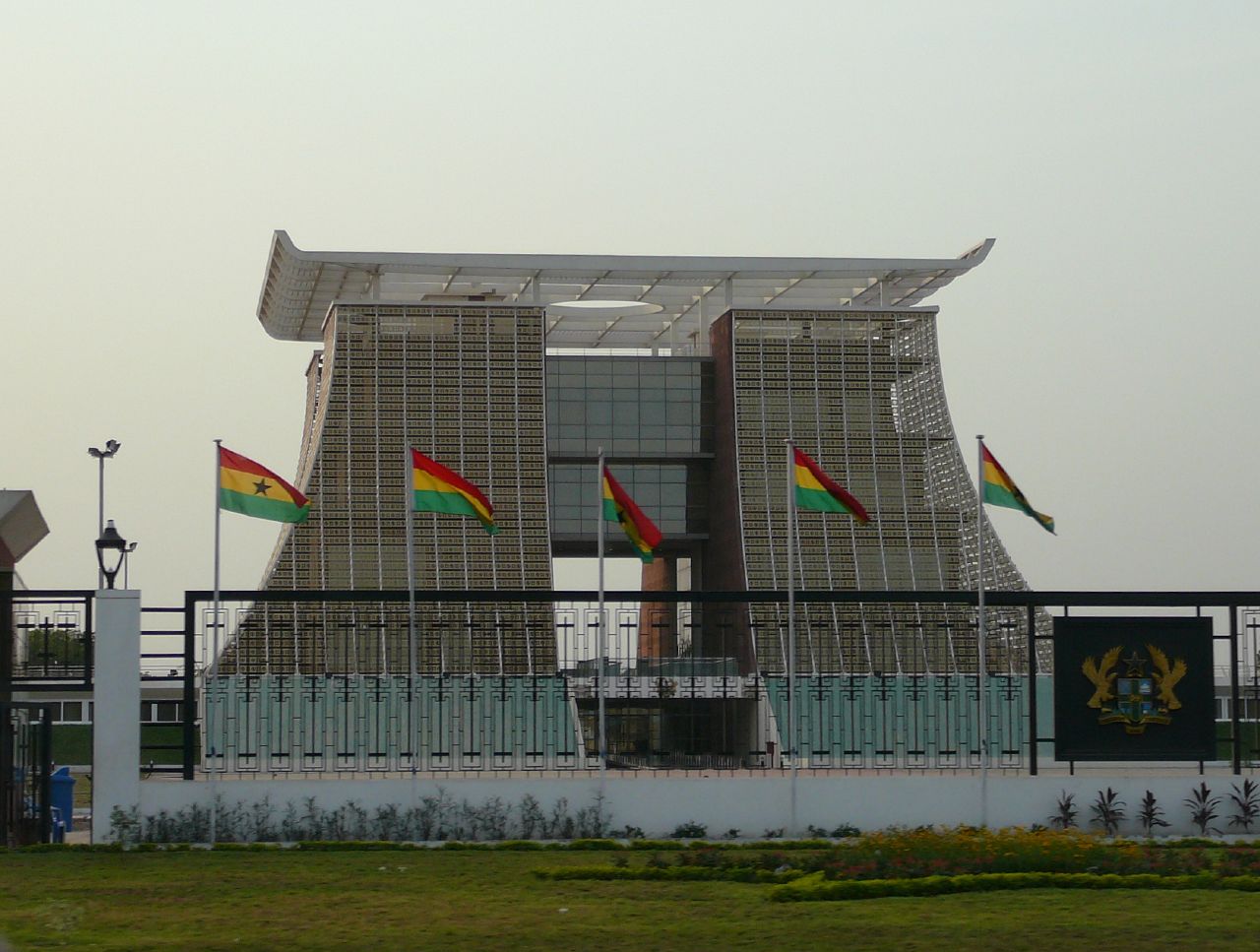 The Flagstaff House - The Presidency
Although the smallest region, it is the most densely populated, containing the two great metropolitan areas of Accra and Tema, the Country's major industrial and commercial centres. Kotoka International Airport is located about 12km from the centre of the city. The City of Accra has been Ghana's capital since 1877, and contains fine public buildings reflecting its transition from a 19th century suburb of Victoriasborg to the modern metropolis it is today. Spreading along the Atlantic coast, the city is well endowed with luxury as well as great value hotels, excellent restaurants and nightclubs. A range of absorbing museums and fine public monuments, modern business and commercial areas, as well as busy markets and tree-lined residential suburbs, is ready to be explored.
Among the highlights of Accra are the National Museum, with its splendid display of exhibits that reflect the heritage of Ghana from prehistoric times to modern times, the National Theatre with its distinctive modern architecture, the Centre for National Culture, Independence Square, the Kwame Nkrumah Mausoleum, the fishing port at James Town and Makola Market.
The University of Ghana at Legon is just 14km north of Accra, and its distinctive buildings are set amongst elegant tree-lined gardens that are popular with students and visitors alike.
The Accra International Conference Centre is the lore most conference centre in the Country, and has played host to many international gatherings.
Tema, on the other land, is a new town some 30km from Accra, with Ghana's foremost commercial port and our large fishing fleet. Its modern industrial zone is one of our major commercial hubs.
The beaches of the Atlantic coast are popular with visitors and Ghanaians alike. Labadi Pleasure Beach and Kokrobite Beach, just 25km west of Accra, are particularly popular at weekends.
Further along the coast is Ada and the estuary of the great River Volta. Here the fine beaches of the estuary and the Atlantic coast provide popular resort areas. Watersports and river trips make this a great place to relax, while the waters off the coast teem with game fish.
The Northern Region, one of the ten administrative regions of Ghana, a country lying on 0 longitude of the West Africa Coast.
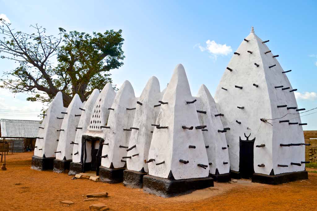 The Larabanga Mosque
Ghanaian hospitality is legendary, the Northern Region is no exception. And so you are welcome to enjoy the scenic natural features, exotic culture and the legacies of a history of the largest region in Ghana.
Northern Region has 13 of the 110 district of the country. Its goegraphical features are mostly low lying, except in the north eastern corner with the Gambaga escarpment and along the western corridor. The land is drained by the tributaries of the Volta Lake: Rivers Nasia, Daka, Oti, the Black and White Volta covering over a third of the whole land mass of the 70,390km big enough to swallow up other regions like Volta, Ashanti, Western and Greater Accra put together; call it the mother of all Regions!
The region if bounded on the north by the Upper East and Upper West regions, on the west by Cote DIvoire and on the east by Togo. The regions on the south are the Brong Ahafo and Volta regions.
With population of nearly 2 million, the main ethnic groups are Dagomba, Nanumba, Mamprusi, Gonja and Komkombas. Other groups include Chekosis, Bimobas and Vaglas.
Tamale, the capital, is the country's fourth largest city. It is the nerve centre of all commercial activities in the whole of the Northern Sector of Ghana. Tamale is an incredible juxta-position of the ancient and modern. The traditional architecture of round huts with conical thatched roofs are sights to see.
The rains come between May and October followed by the dry season which peaks in December and January with the dry Harmattan winds from the Sahara Desert. This tropical climate sustains the Guinea Savanna vegetation made up to grassland, clusters of shrubs, short trees and a sprinkling of big trees like mahogany and baobab. Maximum temperature levels of about 38oC occur in March to April and minimum temperature levels of about 19oC in January.
With a population of 917,253 the Upper East region covers 7.8% of Ghana's land mass. It is the gateway to Ghana from Burkina Faso, which is the traditional crossroads for the trans-Saharan trade routes.
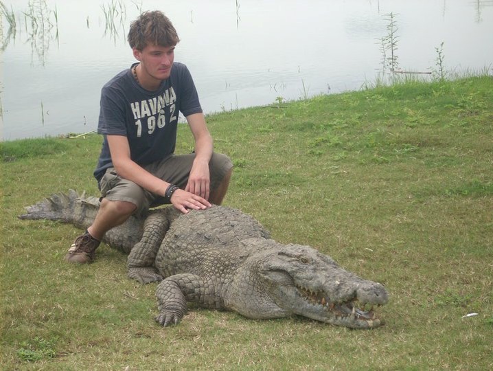 Paga Crocodile Pond
An exciting introduction to Ghana, much of the landscape is broad savannah grasslands, dotted with the strange-looking baobab trees, or striking Sahel terrian. In the villages, with their distinctive round huts, communal activities go on as they have for generations. The principal border posts from Burkina Faso are found at Hamale, Kapulima. Paga and Kulungugu.
For political administration, the region is divided into six Districts: Bawku East, Bawku West, Bongo, Builsa, Kassena-Nankana and Bolgatanga (or 'Bolga' as it is known locally) being the capital of the region has always been a meeting point for traders from Mali and Burkina Faso on their way south to Tamale and Southern Ghana. The markets continue to be important trading points, and 'Bolga' is a famous centre for handicrafts, including straw hats and baskets, leather goods and metal jewellery.
The local villages with their distinctive building styles that have evolved through the generations, and adapt so well to the lifestyle of the people and local conditions, provide a distinct contrast to those in other parts of Ghana and welcome visitors.
The Upper West Region has a land area of 8,842 square kilometres (3%) of Ghanas total. The Dagarba, Lobi, Sisala, Vagla and the Wala, all of who speak distinct languages, inhabit this region.
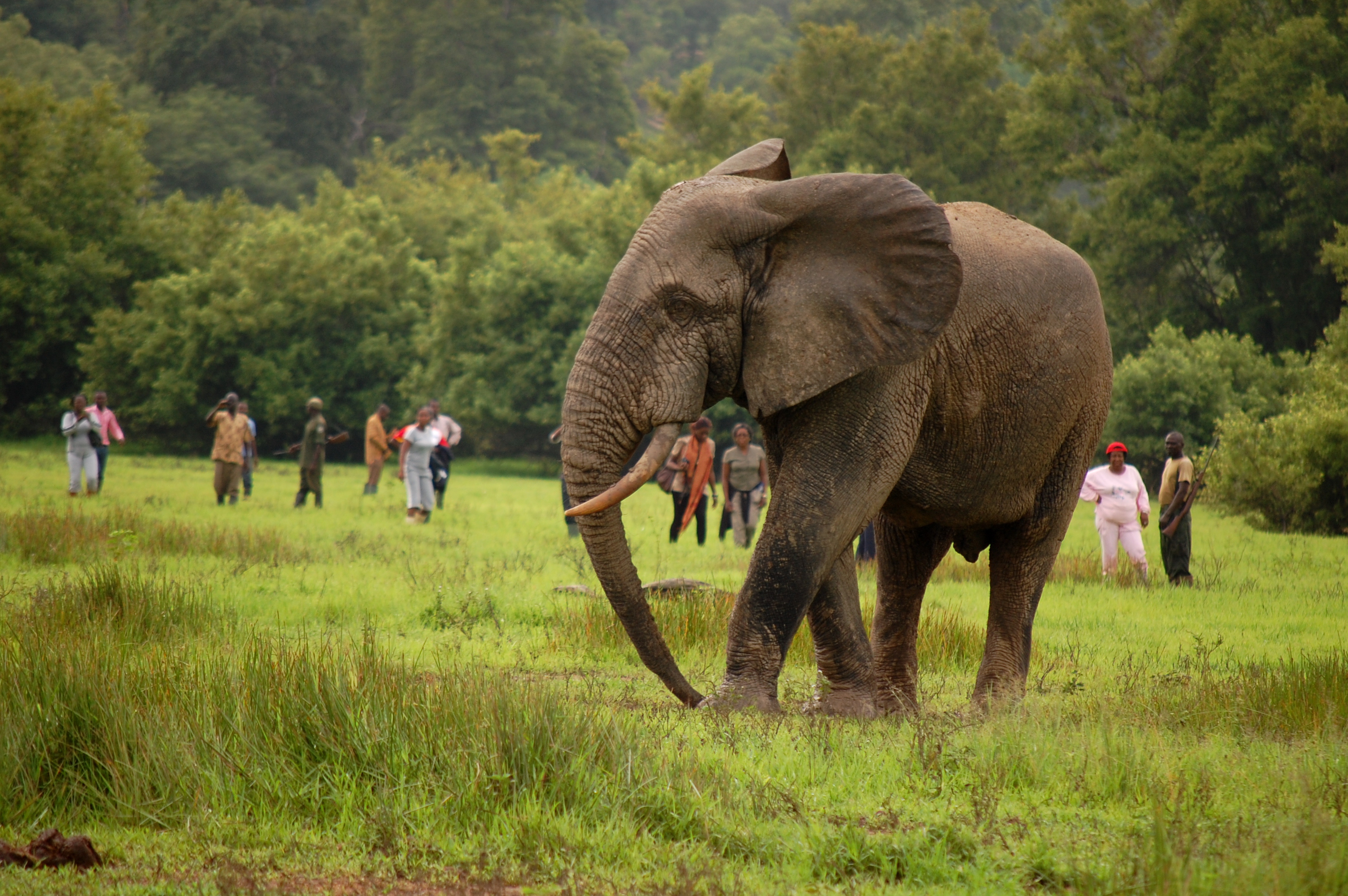 Mole National Park - Damongo
Total population of the region, which comprises five administrative districts Jirapa-Lambusi, Lawra, Nadawoli, Sissala and Wa, - is 573,873. It is the gateway to Ghana from Burkina Faso, which is a traditional crossroads for the Trans-Saharan trade routes. An exciting introduction to Ghana, much of the landscape is broad savannah grasslands, dotted with the strange-looking baobab trees, or striking Sahel terrain. In the villages, with their distinctive round huts, communal activities go on as they have for generations.
The principal border posts from Burkina Faso are found at Hamale, Kapulima. Paga and Kulungugu.
The Upper West Region has a different feeling, as a more traditional region. The capital of the region is Wa which is also the seat of the Wa Naa, Paramount Chief of the Walas. The magnificent palace still stands as stately as it did when it was first built in the 19th century. The uniquely styled traditional village houses of round mud-walled structures connected by walls forming large compounds are well adapted to the demanding climate of this region.
Gbelle Game Reserve, located 17km south of Tumu, is an important sanctuary for endangered species of wildlife, as well as hippos, elephants and bucks. Birdwatchers consider this an important habitat for indigenous and migratory birds.
Although a great deal of development is taking place in these regions, access to outlying areas can be difficult at certain times of the year and during and after heavy rains.
The most easterly region of Ghana, bordering on Togo, the Volta Region is an area of extraordinary scenic beauty.
 Wli Waterfalls
The rolling hills and valleys, rocky outcrops overlooking Lake Volta, and lagoons, rivers and waterfall make for one of nature's most attractive gift to Ghana. The region stretches from the coastal plains on the Atlantic coast right up to the arid lands of the north, and climatic conditions can vary tremendously. From the coastal plain, fringed by sun-dappled beaches and mangrove swamps, through moist deciduous rain forests in the central belt, where Mt. Afadjato at 885m is the highest point in Ghana, to the arid savannah of northern Ghana, you can experience almost every tropical climate in West Africa.
This region is also dominated by the River Volta and Lake Volta, on its western flank. The lake is a source of power, and much of the water for the region; it is the water highway to the north, a great fishing lake as well as a popular recreational area.
The festivals and ceremonies reflect the rich diversity of history and culture of tribal life in the region. The relics of European coastal forts and other structures still remain, while further north vestiges of the German colonial era are unmistakable. The regional museum at Ho is an ideal place to understand the background to our heritage.
Hohoe is an important centre of herbal medicine, which is of significant and growing importance both in Ghana and the western world today.
Discover the Wli Waterfalls in the tropical forest near Hohoe, the highest in Ghana, or the nearby Tsatsadu Falls at Alavanyo, or the Tagbo Falls at Liate Wote which are almost as spectacular. Afadjato Mountain attracts climbers of all ages, while the Kalakpa Game Production Reserve is a special place for environmentalists.
Volta is famous for its festivals and ceremonies, of which the Hogbetsotso of the Anlos people in November is probably the most famous. The people of Wli have a unique festival to give thanks for the gift of water.
The main gateway from Togo is at Aflao, and hotels, guest houses and restaurants can be found in all the main centres, including Ho, Keta, Kpando and Hohoe.
The beaches of the Volta estuary are amongst the best in Ghana. Swimming is popular in some areas, although the sea is generally rough along the Atlantic coast. New hotels are providing facilities for waters ports and deep sea fishing. Tuna, tarpon and barracuda may be caught, and arrangements can be made in advance through the local hotels.
The region is located at the eastern part of Ghana, sharing its eastern boundary with the Republic of Togo, western with the Volta River and Lake. The southern border is the Atlantic Ocean, wile the north shares a boundary with the Northern Region.
The main economic activities are farming, fishing, animal rearing, petty commerce and tourism.
The people of the region are made up of Ewe, Adele, Nchumuru, Akpafu, Atwode, Lolbi, Tafi, Avatime and Akan. Others are Santrokofi, Nyagbo, Buem, Bowiri, Logba, Ga-Adangbe.
The Western Region of Ghana us an integrated complex of beautiful safe beaches and African touch beach resorts.
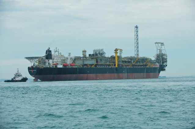 The Floating Production, Storage and Offloading (FPSO) Vessel.
It has the largest collection of European trading forts (later used in the slave trade); the highest tropical jungles; numerous mines, picturesque villages and friendly people; and old architectural styles and vivacious festivals. The region's water villages on stilts are amazing to experience. A visitor can charter a local canoe out to the village and actually stay over night in a guest house on the water.
The region is located in the south-western part of Ghana and shares boundaries with the Central, Ashanti, and Brong-Ahafo regions. To the West it shares a border with the republic of Cote D'Ivoire. The region has 192 Km of tropical beaches on the Atlantic Ocean and a tropical climate characterized by moderate temperatures all year round.
The native people of the Western Region are mostly Akans, speaking various dialects including: Ahanta, Nzema, Sefwi, Wassa, Brosa, and Pepesa. Principal religions are Christianity, African Aminism and Islam.
Principal economic activities include agriculture (cash crops and food crops), fishing (commercial and subsistence), and mining and manufacturing. The main exportable produces are cocoa, timber, copra, coffee, rubber/latex, gold, manganese, and bauxite.
HONOURABLE SHIRLEY AYORKOR BOTCHWEY


